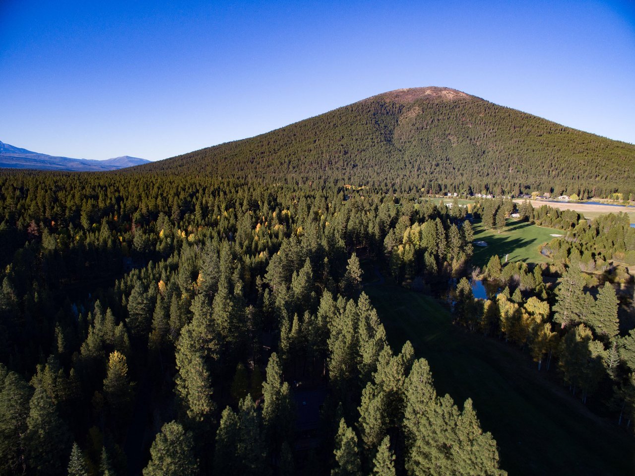
Start at Sylvan Park, at the small lot past the play structure, and the walk up feels like it should end somewhere. The maintenance road climbs past a gate, ponderosa pines close in overhead, and after a few hundred yards you hit a chain-link fence guarding a cluster of communications towers. A posted No Trespassing sign tells you to go left, not right, even though the trail clearly continues both ways. The actual high point of Awbrey Butte, the highest rock pile in Bend, sits somewhere between that fence line and the water tower. You can walk within a few dozen feet of it. You cannot stand on it.
That's the thing almost nobody explains about living on top of this hill: the summit itself was never meant to be a destination. It's a utility easement that happened to end up at the highest elevation in the city, and the entire trail network on the butte is built around walking past it, not to it.
A summit that was spoken for before the neighborhood was
Brooks Resources bought roughly 1,800 acres on and around the butte in 1970, back when most of Bend still thought of it as an unreachable hill rather than a place to build a house. The first lots didn't go on the market until 1984, near Glassow and Tower Rock, selling for around $25,000. Getting water up to that elevation was the early engineering problem the company had to solve before anyone could live there at all. Separately, a reservoir and a fenced tower compound now occupy the actual peak. Development wasn't finished until 2005, by which point the neighborhood had grown into roughly 782 homesites spread across the butte's flanks.
That timeline matters because it means the infrastructure came first and the recreational trails came second, threaded around water tanks and telecom lines that were already locked in place. Unlike Pilot Butte across town, where you can drive or hike straight to a marked overlook at the literal top, Awbrey Butte's highest point was claimed by pipes and antennas before it ever had a chance to become a public viewpoint. The neighborhood's outdoor identity formed around that fact instead of fighting it.
The two parks doing the actual work
Sylvan Park and Summit Park are the pair that make the fence-line walk possible, and they're smaller and quieter than their job description suggests. Sylvan Park, established in 2000, has a playground, picnic tables, and mature landscaping that gives it more shade than most butte parks. Summit Park is little more than a pocket of green a few streets over, but it's the other end of the connector.
Between them runs the Summit Sylvan Trail, a short stretch of single track that does the real work of linking the two parks around the fenced summit. It's not marked with a trailhead sign or a parking area of its own. You find it by walking through Sylvan Park past the play area, following the private maintenance road to the gate, and peeling off left before the fence. From there the trail drops gradually past the backs of several yards until it lets out at Summit Park, and from certain points along the way you get views straight across town to Pilot Butte and Powell Butte. It's the kind of route a longtime resident already knows and a new one has to be told, because no single map shows the whole connection in one piece.
Down the north side, into someone else's canal
Cross Mount Washington Drive from the fence-line trail and the terrain changes completely. The Archie Briggs Canyon Trail, with a trailhead at 3360 NW Panorama Drive, drops through juniper and pine on the north slope of the butte and eventually meets the Deschutes River Trail below. That river-facing stretch of the Deschutes River Trail, the segment locals call the Awbrey Reach, isn't a natural path at all. It's built directly on top of the old Tumalo Feed Canal, an open irrigation ditch that got replaced by a buried polyethylene pipeline in a project that finished in 2005, the same year Awbrey Butte's build-out wrapped up. The wide, flat track you're walking on is really a pipeline access road with a river view.
Across the canyon sits the Riley Ranch Nature Reserve, close enough to see clearly and impossible to reach directly from this side. There's no bridge connecting the two, and the Bend Park and Recreation District is explicit that the North Reach through Riley Ranch doesn't allow dogs at all, on the trail or in the park. For a neighborhood where a lot of daily foot traffic comes with a leash attached, that's a real constraint worth knowing before you plan a route: the river-view side of the butte is a look-but-don't-cross arrangement in more ways than one.
West off the butte, into a much bigger trail system
Head the other direction and the scale changes again. Awbrey Butte sits close enough to Phil's Trailhead that residents can treat it as a neighborhood amenity rather than a destination requiring a drive. Phil's Trailhead is the main access point into the Phil's Trail Complex, one of the most heavily used mountain biking networks in the Pacific Northwest, with named runs like Ben's, Kent's, Whoops, Tiddlywinks, and the jump lines at The Lair. The system traces back to 1984, when Bob Woodward, later a Bend mayor, and his friend Phil Meglasson started improving a deer trail through a canyon west of town. Four decades later that same deer trail has become the namesake of hundreds of miles of singletrack, and it starts a few minutes from Awbrey Butte's western edge.
The contrast is worth sitting with. On one side of the neighborhood you're boxed in by a fence protecting a water tower. On the other, you're a short walk from a trail system with a Strava segment recorded by tens of thousands of riders. Both are part of the same afternoon loop for a lot of people who live here.
What's waiting when you come back down
The walk back to the neighborhood usually ends at Awbrey Village Shopping Center, at NW Mt. Washington Drive and Summit Drive, which covers the basics: a bank, a grocery store, a handful of restaurants and cafés within a few minutes of most homes on the butte. It's not a destination shopping strip. It's built for the errand you run on the way home from the fence-line trail, not the one you plan a trip around.
For a sit-down option with the same view you just spent an hour walking around, Nineteen at Awbrey Glen sits inside the Awbrey Glen Golf Club, with a dining room, a more casual Grill Room, and an outdoor deck that looks out over the course toward the Cascades. It's the same Cascade view from the trail, just from a table instead of a switchback.
None of this changes the fact that you still can't stand on the actual top of Awbrey Butte. The fence has been there since before most of the houses were, and it isn't moving. What changes is how you use the rest of the hill once you stop expecting a summit and start treating the loop around it, from Sylvan Park to the fence line to Summit Park, from Archie Briggs down to the old canal road, from the butte's western edge into Phil's Trail Complex, as the actual point of living up here.
Deer are common enough in the yards and green spaces on the butte that most residents stop remarking on them after the first year. It's one more sign that the wildest part of this neighborhood was never the summit. It's everything built around it.
If you're curious how a specific street or subdivision on the butte fits into this layout, or you're weighing a move within Central Oregon and want someone who actually walks these trails, Team Fitch is happy to talk it through.
This article is general information, not legal, tax or financial advice. Consult a qualified professional about your situation.